After a cold night in the hostel, I went back to the resort in Saskatchewan Crossing to have a proper and warm breakfast, before resuming the path to the North. My first stop was a short hike that a Philosophy teacher, who knew the park very well, and who was one of the guests in the hotel, had recommended us. So I went to see the Panther Falls and the Bridal Veil Falls, although I had to go back before the latter, as the trail entailed some risks, there was nobody there, and it is not one of the popular trails in the park. Nevertheless, it is a nice place to go if you are at least two people.

The following two stops were the opposite: perfectly marked trail and very popular among the visitors to the park.
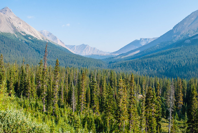
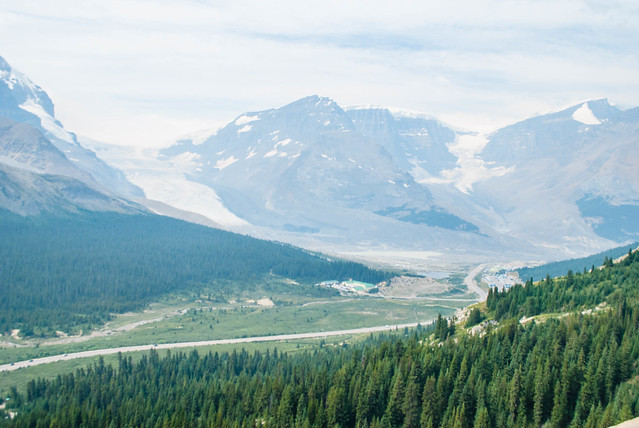
The first one was the Parker Ridge Trail, which led the hikers to a wonderful view of the Saskatchewan Glacier, although a bit far. The next one was the Wilcox Trail, which leads you to a perfect spot to admire the Athabasca Glacier, the most popular one in the whole park due to its size, and the close it is to the parkway. The Icefields Columbia Centre is the basecamp for the different activities the glacier offers, and a good place where to stop, and have lunch in the terrace a few hundred metres away from the ice.

I took easy the rest of the day, so I just drove to Jasper. Jasper is the other town in the parks, but less crowded than Banff. It is also true that I did not stay in any of the accommodations in the town, but in a hostel in the outskirts. This hostel was another wilderness hostel, so no water, and not even a sauna this time! The truth is that we had some good laughs with the rest of the guests, and managed to get some insights about North America: like the real estate situation or the cost for university.
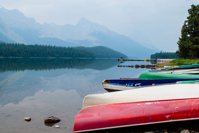
The morning after I drove some of them down to Maligne Lake: a German Mathematician working for an insurance company, who was solo travelling and hiking before he meets his Indian penfriend for 20 years, and an American lady and her daughter who happened to have lived in Madrid years ago. The morning was dark as it was cloudy, so the lake did not impress me that much, although it was probably nicer with more light. It was a nice opportunity to see the American talkative skills in place: they easily start conversations with strangers, and you always learn from those situations. In this case, I was part of some talks about fishing in the lake, and a masterclass about inflatable canoes.
Apart from Maligne Lake, there was time to stop in Medicine Lake, which had a terrible landscape around, as most of the hillsides around it had been burnt in a fire a few years back. Before heading towards Edmonton, I stopped in the very famous Maligne Canyon, which is a long and deep canyon, well prepared for visitors staying in Jasper. I only did part of the trail around it, as it did not have that much new to offer, and I had a 4 hours drive yet to Edmonton, where I would fly the day after to Vancouver Island. I had been told there was nothing to see in Edmonton, so I just relaxed on the huge bed in the airport hotel.
Banff and Jasper had not disappointed me at all: one of the most beautiful areas I had ever visited: both beautiful and impressive, and leaving me the feeling that I should have planned a longer trip in these parks to explore it better. Hopefully, life is long enough to bring me back there.
Like this:
Like Loading...
When I travel to a new and distant place, it always takes me some time to feel comfortable. I always spend the first hours/days in understanding how things work: how the map I had seen dozens of times and the idea I had about the place correlate with reality, and how the different recommendations really applied. The good thing of North America is that the latter part is easy to predict (movies help), and this time was not an exception. After the first day, I already had a sense of distances, and the logistics that implied.

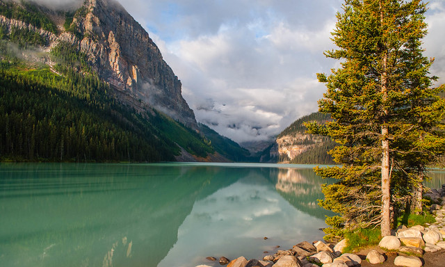
Hence, I changed my original plan and started my day in Lake Louise. It was a cold but sunny morning, and the lake view was as breathtaking as the travel guides described. Since I had been there the day before, I did enjoy the calmness of the lack of tourists. We were just a few of us who had made it that early there. No bus had arrived yet, and the canoe place employees were only starting to set up their business.

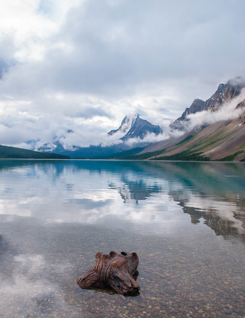
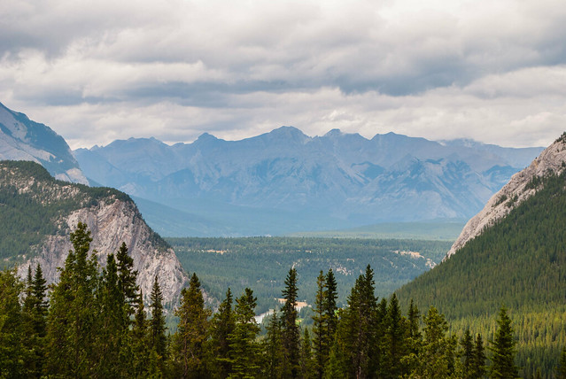
My day continued with the Icefields Parkway, which follows the Bow Valley, and whose name is quite representative of the reality: imagine a valley, in between huge mountains, and with glaciers at both sides of the valley, and with several lakes along the way, like the small Herbert Lake with the morning mist, or the beautiful Bow Lake, wonderfully complemented with a glacier and a waterfall.
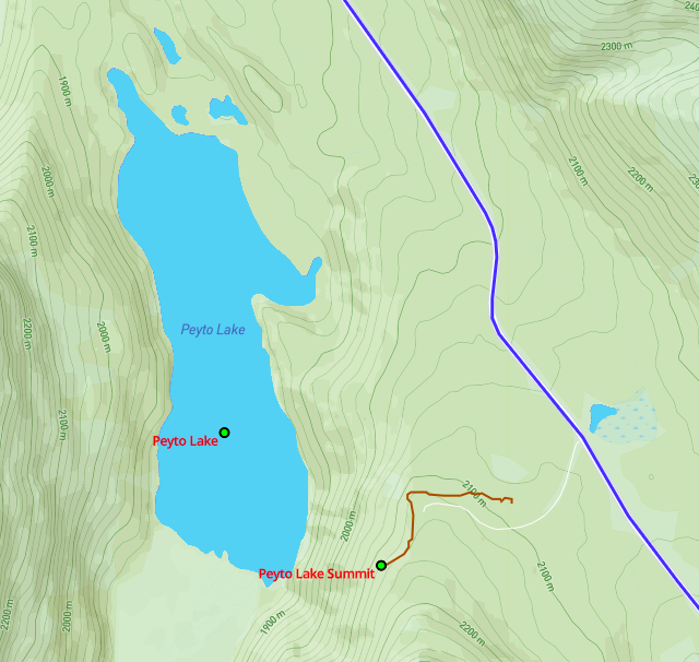
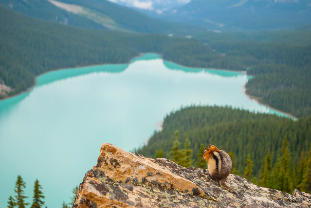
After the Bow Lake, I parked the car near Peyto Lake, which is well prepared for hordes of tourists to easily access to that wonder of the park. Nevertheless, I saw in my Maps app that there was a trail up to the summit, so I did follow it.
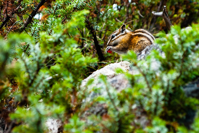
There I found myself with a much better view of the lake, the surrounding mountains, and the glacier, and had the only company of a squirrel, who was nice enough to pose for my came while she enjoyed the view.
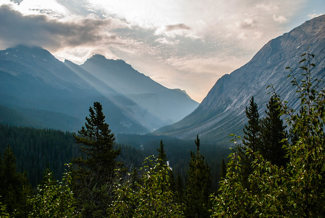
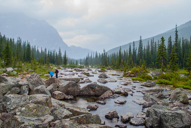
When I was in the High School, I loved studying Geology. I found it very interesting to see how several factors could shape the world to what we actually see, and that the landscape is constantly changing even if we cannot realize. The whole trip was full of actual examples of what I had learned back in my youth, the glaciers, the valleys shaped by them, and the spectacular canyons shaped by the water, like Mistaya one: another easy-to-access canyon, after a short and easy hike, in spite of the rain alarm.

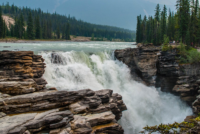
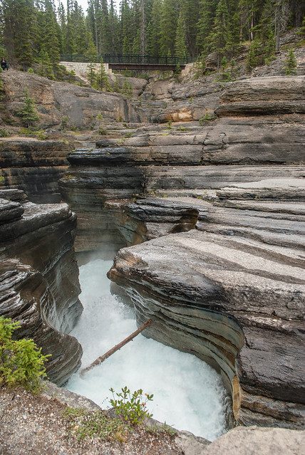
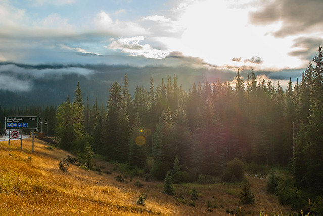
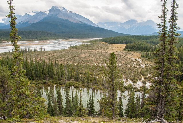
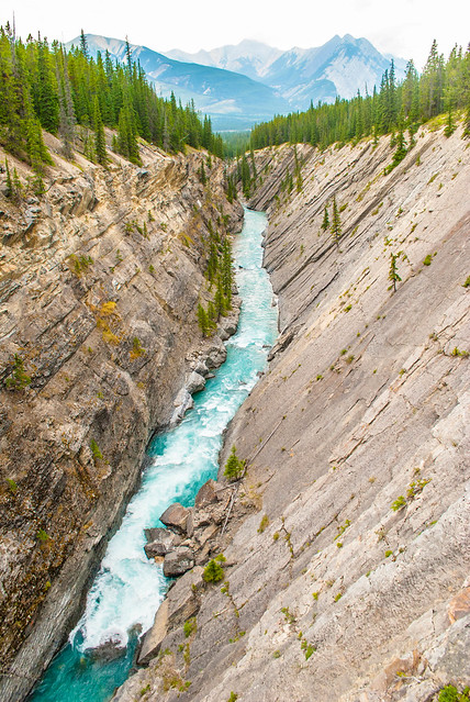
After the Geology class, I arrived to the historic Saskatchewan River Crossing: an area intensively used by the first nations and colons to cross the river, as the wide valley allowed their horses to cross the river. In this area, a small resort has been set up, with ridiculously high prices, as it is the only one in some 100 km. From there, I took a perpendicular road to go out from Jasper park, and I went to the Kootenay Plains Ecological Reserve. A safe hike took me to the Siffleur Canyon, an amazing V-shaped valley formed by the river, and to the Siffleur Falls.
Done with hikes and views for the day, I drove to the hostel, realizing that it was in the middle of nowhere: with no current water, but a creek where water could be taken from and boiled to get warm in a wool-fired sauna. Surprisingly enough, this place had Internet (satellite Internet), and electricity thanks to a turbine in the creek. Although it had less services than any accommodation you can be used to, and less entertainment outside of it than a hostel in a town, this kind of hostel provide the opportunity to really exchange experiences and talks with the other guests. Sometimes you get to know something, sometimes you have fun, and some other times you can learn of how many ways of living exist in the world, like the hostel manager, already in his 50’s, who had quitted a career as a car broker to have more time for doing outdoor activities, or the several people who engaged in a surprisingly conversation about astrology.
Like this:
Like Loading...
Banff town was my basecamp for exploring the Banff park, not only because I wanted to have some services around after long days in the nature, but also because it is where the vast majority of accommodation is based. When I walked out from my hostel and walked to the town centre, I could not avoid thinking of Interlaken (Switzerland), where I had been a few months earlier, or Benidorm, in Spain. All three places had the same origin: a small town which was not born as touristic place, but which are now mere tourist resorts. Since I was in August in Banff, all hotels had no vacancy, and the streets were full of families from all over the world shopping, dining in their restaurants, and buying some food for the next day’s excursions.

In order to have some flexibility, I also bought some supplies for the next day, which started really early thanks to the jetlag. There are two roads to go North from Banff, one is a highway, and the other one is the Bow Valley Parkway. The latter was my choice to start the trip, as it is a mountain road, with less traffic than the highway, but much nicer views of the mountains, the Bow river, and the meadows in the valley.
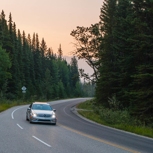
My first stop was in the Johnston Canyon, where a nicely preserved path through the canyon brought me to the Lower and Upper Falls giving a first glimpse of what these days were going to be about. The hike was just 5.5 km in total, and is worth it. I was very happy when I returned to the parking and saw a couple of buses arriving to this spot. I was ahead of time thanks to the jetlag… or that is what I thought.
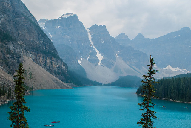
My next planned stop was Lake Louise, one of the highlights in the park, but it seemed that everybody else had gone directly here, and I could not arrive there: it was full. So I looked for a plan B, which was Lake Morraine, a nearby lake… which was also full, but I had good timing and they let a few cars in, and one was mine!
Lake Morraine was my first contact with a glacial lake and it is unforgettable: the huge mountains surrounding them, and their particular turquoise water makes them unmissable. The water is freezing (less than 10 degrees in summer) as it comes from glaciers, and it has rock flour in it. This rock flour is the fine powder resulting from the glacier ice grinding the rocks, formed by rocks, gravel and silt, which is washed into the lake by the meltwaters. This flour absorbs all colours of incoming light except the blue-green that is seen.
Once I recovered from the impressive view of Lake Morraine, I started a hike to Consolation Lakes, less than 6 km in total, although it was quite deceiving for a couple of reasons.
The path was emptier than I expected so my level of attention had to be higher, it rained during most of the hike, and the Consolation Lakes were not as beautiful as I would have expected (I do not see a lot of pictures when I plan the trips, I rely on descriptions). Before leaving the area, a sudden traffic jam caught my attention to its cause: a black bear walking in between the trees next to the road.
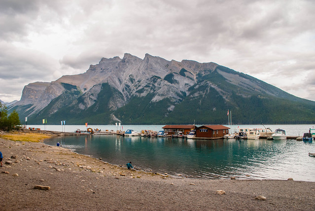
I decided to go back to Banff and as the weather was better, I drove to Lake Minnewanka. This lake is very popular for families to spend the day there, and it is one of the few ones which can have motorboats in it. One of the borders of the lake is a dam, as the original lake was expanded in the first half to the 20th century. It should be a nice and pleasant place to be, if it was not because one of the hikes had been banned by authorities, as a bear had been seen a few days earlier. The alarm was clear, but still some people ignored it. Like the Korean lady who was in my hostel, and who told me she had been hiking there, and seemed to be surprised not many people were hiking…
Before returning to the hostel, I paid a visit to the Banff Hotsprings, which is always a good way to recover from a first long day of driving, hiking, and raining while still admiring the views.
Like this:
Like Loading...
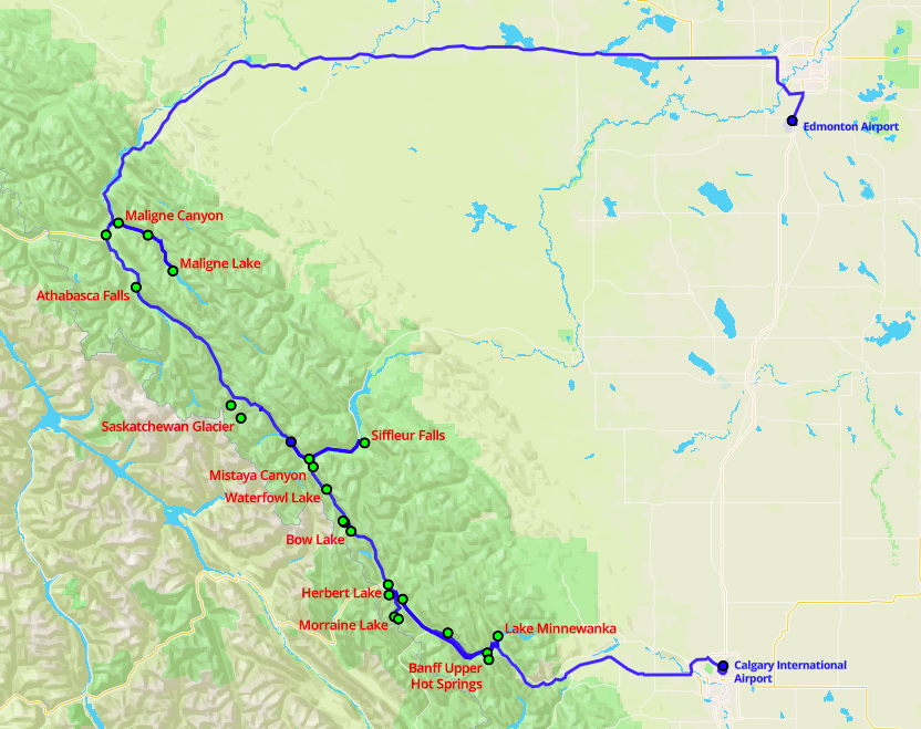
Banff and Jasper natural parks need a few days to be discovered. The more, the better. I had to accommodate this visit in five days, so it was quite intense in terms of driving: 1249 km in 19h15’ on my own. This was very good in a way, as I had plenty of time to reflect, to take pictures, and to enjoy the views in a calm manner. It was also very practical to change the plans according to the weather forecast, and have a bit crazy jetlag-early-bird schedule, starting the days before 7 a.m.
The bad side of my loneliness was that I chose to be very conservative in terms of hiking. Although most of the tracks are really well preserved, and should not mean any hazard, the risk of having an encounter with a bear, or having any kind of accident, made me stay within very popular tracks, where I would see people very often.

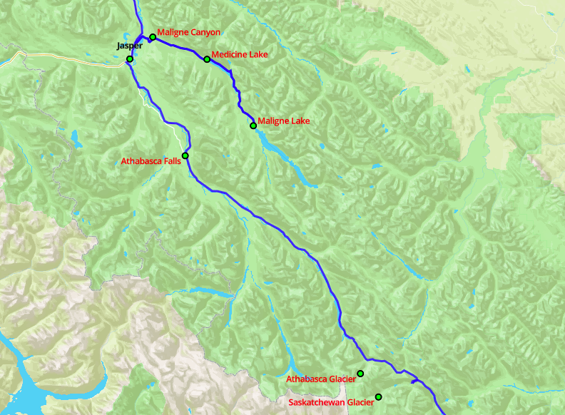
The parks have two towns: Banff and Jasper, and one resort at the Saskatchewan River Crossing. The rest of human life are some campings, and isolated accommodations, so take that into account if you plan a trip there. Just for you to have a clearer idea of how it is: in the southernmost part of Jasper park, there is no mobile coverage for almost 100 km.
Like this:
Like Loading...

Based on the excuse of visiting a friend living in San Franciasco, we organized a 10-day trip around California and hitting Las Vegas as well. A lot of miles (they don’t use kilometres over there) with what they consider a “too small” car (Ford Focus, Kia Soul), including nature (Yosemite Park, and the Central Coast), desert (Death Valley), craziness (Las Vegas), big cities (Los Angeles, San Francisco) and coast towns (Santa Cruz, Santa Barbara, etc).
I will split the trip in three different posts to make it more readable, and make the pictures also viewable without falling asleep. The first part covers Yosemite and Death Valley, the second will take from Las Vegas to half of Central Coast, and the last part will cover the second part of the Central Coast to San Francisco.

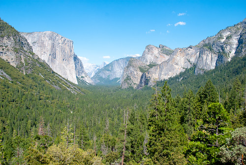
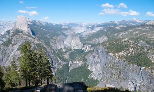
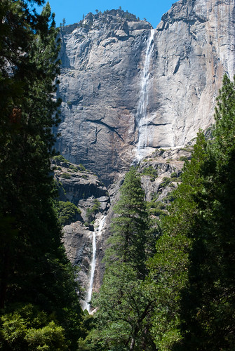
The first day we visited Yosemite. It is one of the famous National Parks in United States and its fame is very well deserved.
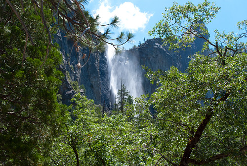
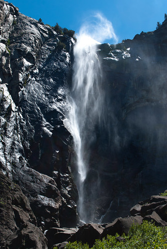
The park surrounds the Valley, which is the result from the presence of a glaciar 10 million years ago, and which now is full of trees, and surrounded by steep granite walls, where waterfalls find their way out (or down).

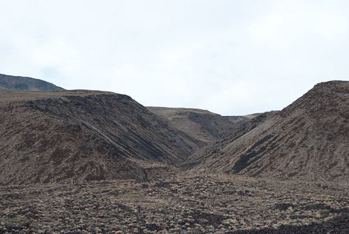
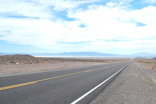
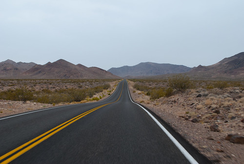
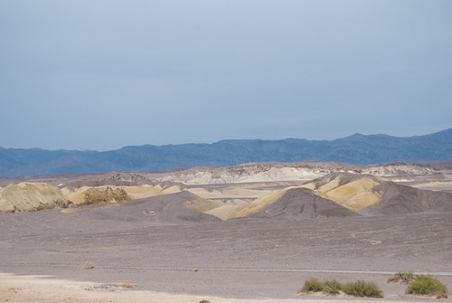
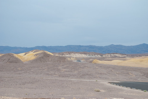
The day after it was time to drive to Las Vegas. Long drive through the desert in Nevada State, and also a quick visit to the deepest point in North America, in Death Valley (which you may guess it is not full of life).
I liked the experience of being in the middle of nowhere for real. We crossed just a couple of small towns, with very long distances among them, and which made you reflect, how it would be living over there, especially when we looked to the steady outside temperature over 40ºC.
Like this:
Like Loading...